
Our Services
Aerial Photography and Filming
We produce Hi Resolution images and video captured from aerial and terrestrial perspectives. Exterior or Interior, our images and footage will add depth and ‘wow’ to your production, whatever your platform and audience. We also produce bespoke full production promotional tools including broadcast quality videos, exhibition display images and online assets.
Applications Include :
• TV, Film and Promotional Video footage
• Marketing, Advertising and PR material
• Wedding Photography and Video
• Events aerial coverage
• Manor Estates Photography and Video

• Real Estate Photography and Video
• Roof and Site inspections
• Sports and Recreational Venue Photography and Video
Aerial Inspection and Site Mapping
Using our Drones for Aerial Surveying is a safe and cost effective way to produce high resolution date and scale accurate maps of land and site areas. We can utilise specified Ground Control Points (GCP’s) in our image processing to accurately position the map in relation to the real world around it. We can also image and map commercial or residential roofs or hard to access areas for maintenance monitoring purposes. We can accurately reproduce the same maps at different time intervals to give a clear overview of project progression.
Applications Include :
• Land inspections for surveyancing
• Agricultural land, forestry and crop inspection
• Large scale commercial roof surveys
• Residential roof surveys
• Date interval construction site progress images
• Solar Panel inspection
• Recreational areas and Park development planning
• Golf course and Commercial fishing lake management
3D Visualisations, Mapping and Modelling
We can execute flight plans that capture 1000’s of images of a subject or area, taken at georeferenced intervals. These images are then triangulated to produce high density 3 dimensional ‘Point clouds’ with a textured mesh overlay to give an accurate, photorealistic appearance of the subject area. Buildings and site areas can be visualised in 3 dimensions allowing accurate measurements to be taken in elevation, volume and scale. The 3D model / Map can be used to generate Video ‘flythrough’ animations or images that give a real world view of of the subject matter from any perspective.
Applications Include :
• Accurate Elevation Maps for Surveyancing
• 3D Modelling of Buildings and structures

• Cross-sectional terrain maps
• 3D ‘Flythrough’ Promotional Videos
• Volumetric measurement of assets such as agregate stockpiles
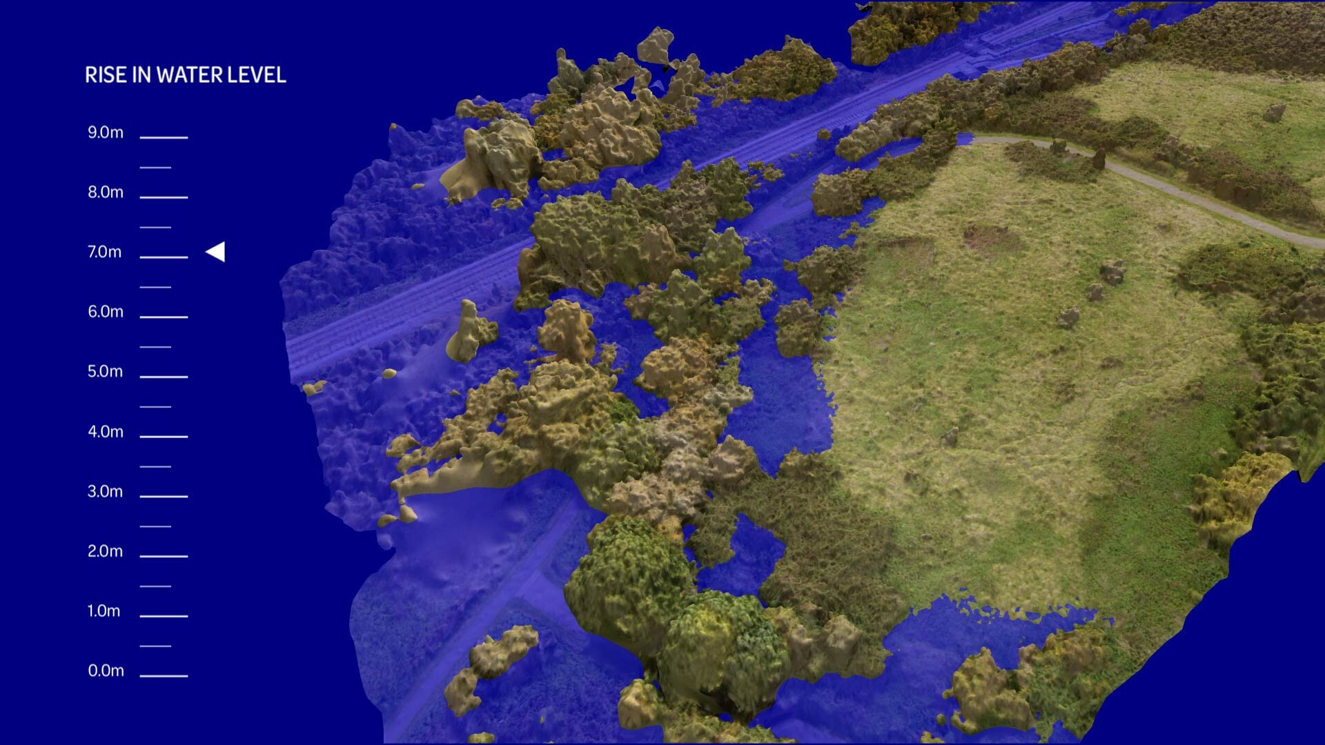
• Flood risk and consequence simulations
• 3D site progress monitoring
• Interactive 3D presentation tools
3D Flythrough and Elevation Map example
3D Flood simulation example

